
Trilogy book covers
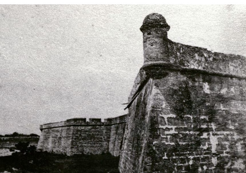
The St. Augustine Trilogy is my young adult series set in St. Augustine, FL. And since time travel to 1886 in relation to that old city is part of those stories, I needed to know what the place actually looked like back then. So after a great deal of research at the local historical society’s excellent research library, I created my own St. Augustine historic map.
Now that map is really a combination of several I reviewed, but most of it is based upon Webb’s Jacksonville and East and South Florida Consolidated Directory – 1886. In those days, St. Augustine had around 4,352 people. The mayor was John Long and the City Marshall was John Papino.

The old boat basin looking back towards the cathedral tower, as well as the old Ponce de Leon Hotel, Flagler College today.
The PDF link below will allow you to see my full color St. Augustine historic map across your computer screen so that you can pick out the details and read the location labels. Note that there was no bridge across the Matanzas River in those days. So if you love St. Augustine and enjoy maps, this is my gift to you. Enjoy.
See links below for related and extended information
Constitution Plaza: St. Augustine, FL
Haunted Lighth0use: St. Augustine, FL
St. Augustine Historical Society Research Library
St. Augustine, FL: Maria Sanchez Creek and Lake
St. Augustine – old maps online
St. Augustine,FL: St. George Street

Add Your Comment